SKI MAPS & OFFLINE NAVIGATION
Less checking.More skiing. Explore detailed ski maps on iPhone. Plan ski routes for your ability and navigate offline. Add spoken directions with Premium, and leave more time for skiing.
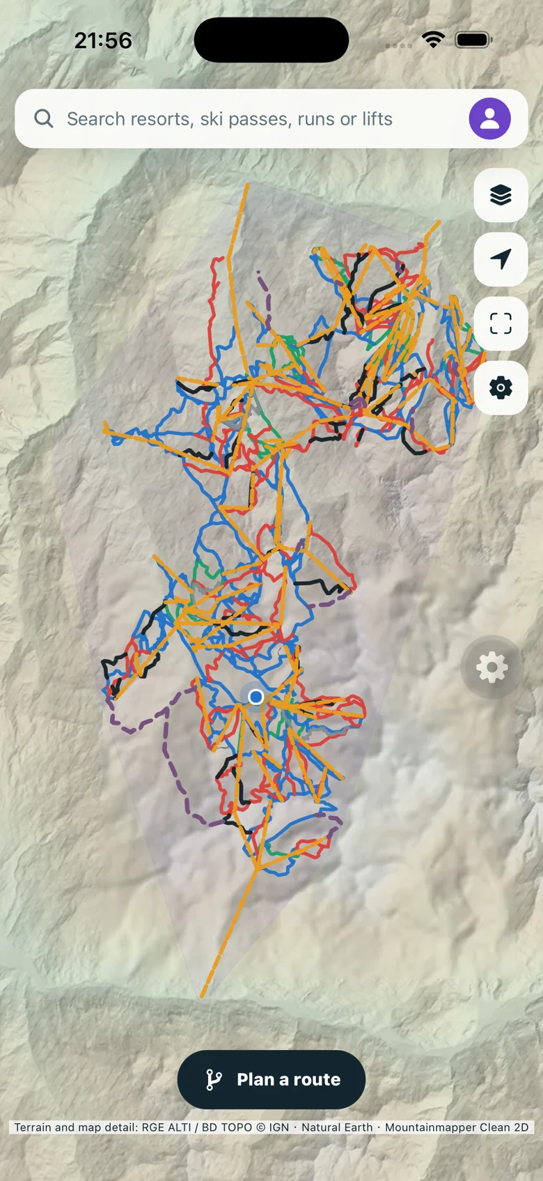
⌖ Les Trois Vallées · In the app
01 PLAN YOUR ROUTE02 FIND YOUR FLOW03 KNOW YOUR MOUNTAIN
MADE FOR DAYS ON THE MOUNTAIN
Ski maps. Route planning.
More mountain. From your first lift to your last run, bring the details together in one clear map.
ROUTES FOR YOUR ABILITY
Your route.
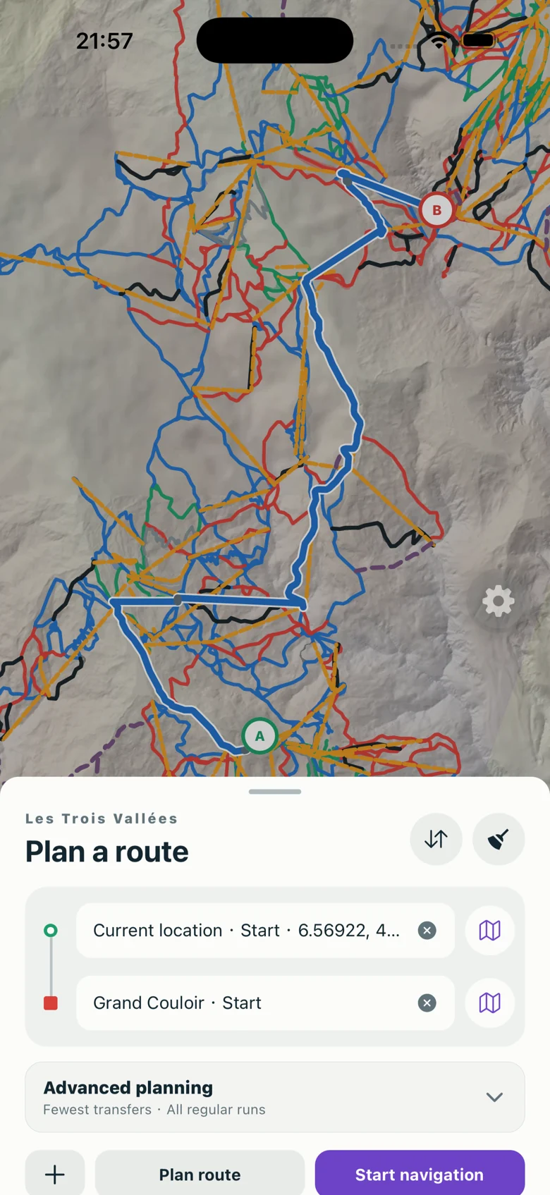
Your level. Choose your start and finish. Connect pistes, lifts and walking transfers into one route, with the difficulty that suits your day.
Free + Premium options Green and blue difficulty limits are free. Red-run limits and avoidance preferences are Premium.
KEEP YOUR GLOVES ON
Hear what’s next.
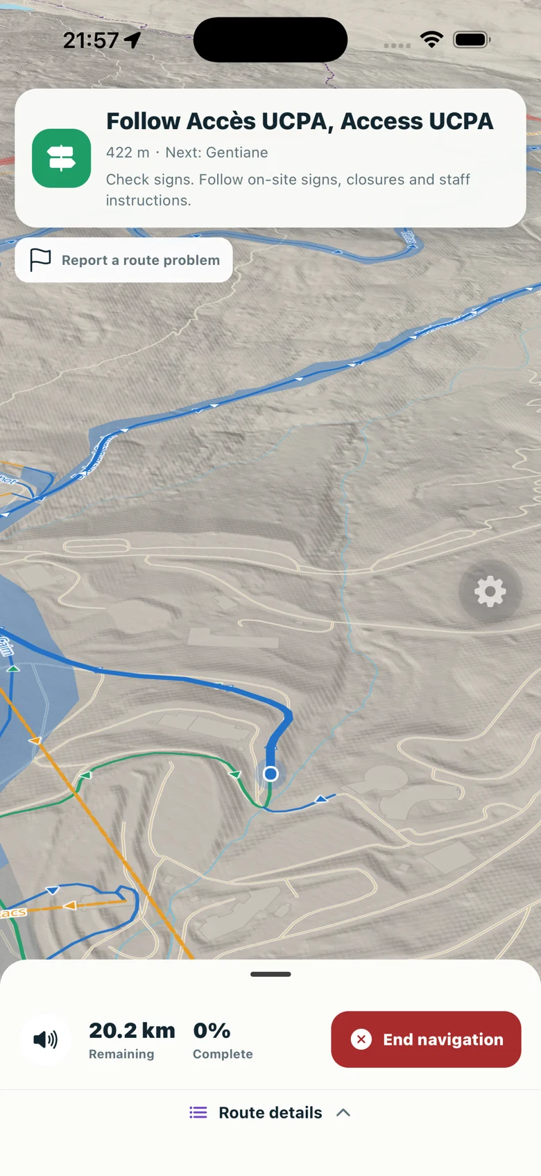
Stay in your flow. Follow visual and spoken directions from one run to the next. With Premium, guidance continues in the background while your phone is locked.
Premium Voice and lock-screen navigation require Premium. Foreground visual navigation is free.
YOUR MOUNTAIN, OFFLINE
Get ready now.
Explore offline later. Download the ski-area map, search data and routing network before you go. Find runs and plan or replan routes without a connection.
Included free Download in advance, keep the app open and use Wi-Fi for large packages.
IT’S ALL IN THE DETAILS
Know the run,
before you go. Look closer at the terrain. Find the lift you need. See which way the mountain goes.
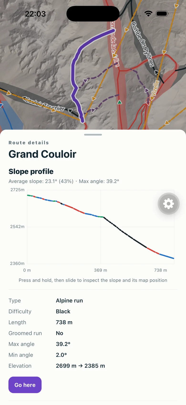
04 Read the terrain Inspect difficulty, elevation and slope profiles before choosing a run.
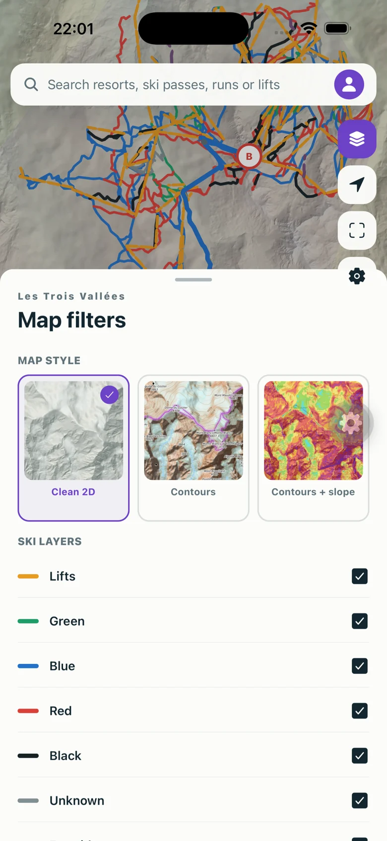
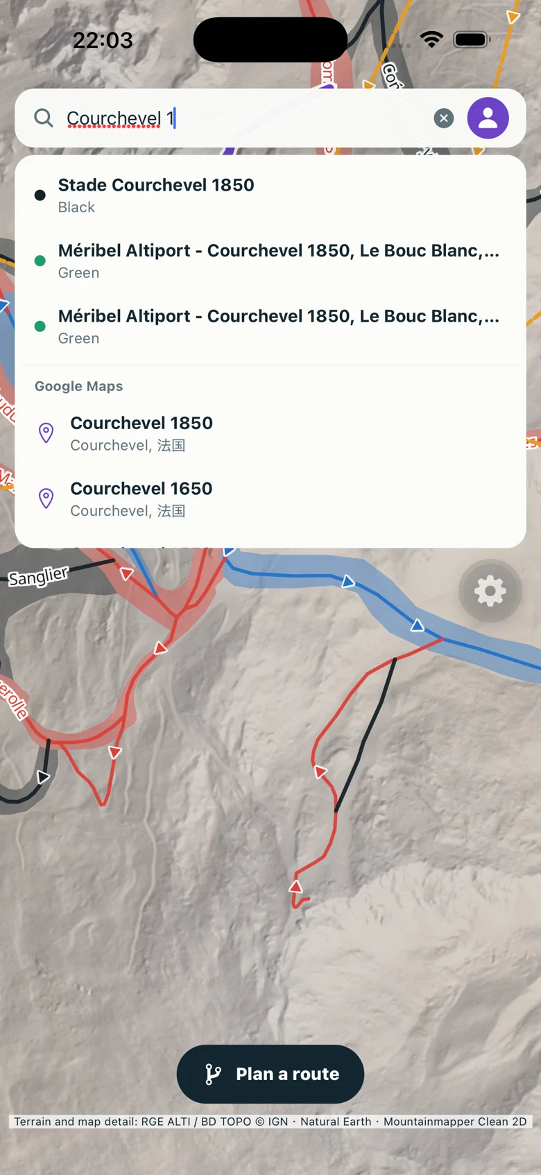
05 Find your next run Search pistes and lifts by name. Choose the map style and layers you want to see.
06 See the direction Follow the small arrows on the map to see which way a piste goes.
MOUNTAINMAPPER
Your next ski day,
with a clearer way ahead. Explore the essentials for free. Add Premium for spoken guidance and more route preferences.
View plans↗ Coming soon to the App Store
A planning aid. Always follow resort signs, closures and staff instructions. Map data may be incomplete or out of date.